SCOTTISH HIGHLANDER
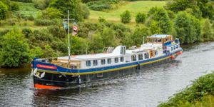
Caledonian Canal (includes Loch Ness)
Up to 8 guests
Charters and Cabin cruises
Themed Cruises:
Family, Fishing, Golf, Whisky

Scotland is full of charm, character, history, and spectacular scenery. The waters of Scotland are among the most beautiful and breathtaking in the world. Your Scottish barge cruise will take you through the magical Great Glen, located between the historic city centre of Inverness and the gorgeous town of Fort William, stretching the east to the west coast of Scotland.
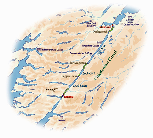
Cruise the Caledonian Canal between Banavie and Muirtown

Inverness is one of the oldest settlements in the Highlands
Inverness is one of the fastest-growing towns in Europe, as well as one of the oldest settlements in the Highlands, lying on a strategic position of flat land between the head of the Great Glen and the Moray Firth. Early signs of occupation were found on Craig Phadrig, a wooded hill to the west of the River Ness and once the site of a Pictish capital.
Later, in the 11th century, Macbeth’s castle occupied the site. Although this is another place where Duncan was probably not murdered, his avenging son Malcolm Canmore burned Macbeth’s wooden stronghold to the ground. Shortly after this, the first stone structure was built on a bluff to the east, and King David I made Inverness a royal burgh. The castle occupies the site today and dominates views of Inverness.
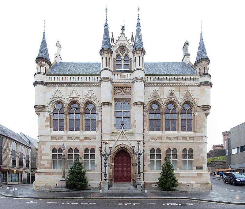
Inverness Town House
The Inverness Town House, built in the Flemish-Baronial style between 1878 and 1882, includes a variety of artwork and historic features. It was the scene of a historic meeting of the British Cabinet in September 1921, the only cabinet meeting of the British Government ever held outside London.
Lying to the west of Inverness, Muirtown is home to the Muirtown Basin. Built as a second harbor for ships on the Caledonian Canal, it unfortunately could not cope with the number of vessels which used its facilities and thus never fulfilled its full potential. Today, it serves as a marina for pleasure craft. Immediately to the south of the basin is the four-lock flight of Muirtown Locks and, to the north, the Muirtown Swing Bridge.
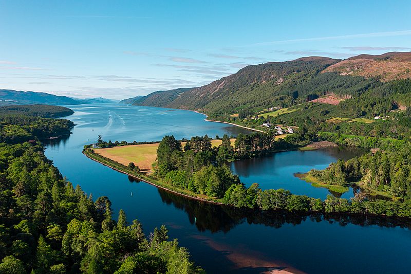
Dochgarroch
Dochgarroch, a small hamlet that lies at the head of Loch Ness, is home to the newly opened An Talla (Gathering Place) visitor center. Occupying the old Victorian-era village hall, the visitor center comprises ticket offices for boat trips on the Caledonian Canal, as well as cafes and shopping outlets. Behind An Talla is Dochfour, a Victorian terraced garden surrounding a historic 18th-century house and home of the Baillie family for over 500 years. Still in private hands, terraced Italianate gardens sweep down to the water’s edge and parkland rises to the woodland above the house. In 1881, the gardens were expanded as part of a scheme which routed a railway through the estate.
Invermoriston’s most visited attraction is The Thomas Telford Bridge. Built in 1813, this bridge crosses the spectacular River Moriston falls and formed part of the main road between Drumnadrochit and Fort Augustus. They replaced it in the 1930s with a new bridge that is still in use today.
Drumnadrochit grew up around a bridge over the River Enrick and its Gaelic name means “Ridge of the Bridge”. The village is popular with tourists and backpackers hiking trails to Ben Nevis and Loch Ness.
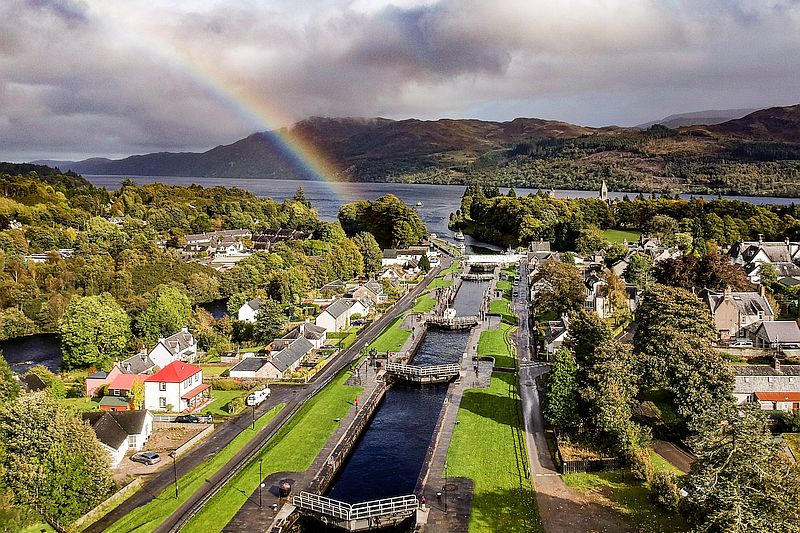
Fort Augustus at the southern edge of Loch Ness
Fort Augustus is a hamlet at the southern edge of Loch Ness. It is suggested that the original settlement, called Cille Chuimein, was named after Saint Colum Cille of Iona, an Irish abbot who built a church on the site. In the aftermath of the Jacobite rising in 1715, General Wade built a fort and named it after the Duke of Cumberland. Wade had planned to build a new town around the new barracks and call it Wadesburgh, but as the settlement grew, it eventually took the name of the fort. The Jacobites captured the fort in March 1746, prior to the Battle of Colluden. In 1867, the fort was sold to the Lovat family and later, in 1876, it was passed on to the Benedictine Order, who later established the Fort Augustus Abbey.
Aberchalder is a small community on the northern end of Loch Oich. The village is named for its location. Its prefix “Aber” refers to “the mouth” or “confluence”, while the suffix "Chalder" translates to “of the calder”. Calder itself is a corruption of Collie Dur, with Collie meaning “off the wood” and Dur used as an obsolete Gaelic term for “water”. At one time, the town was owned by Randolph, Earl of Moray, before passing to Dunbar and later to the Clan Fraser of Lovat, and later still to Glengarry.
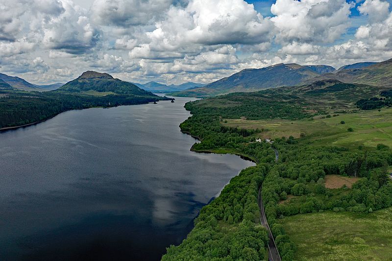
Laggan is on the wild shores of Loch Lochy
Laggan, a small community in the Great Glen, is located close to the site of The Battle of the Shirts which occurred in July 1544 between the Clan Macdonald of Clanranald and Clan Fraser of Lovat in the Great Glen, overlooking Loch Lochy.
The Invergarry and Fort Augustus Railway, which once passed by Laggan, opened in 1896 with the Invergarry railway station at North Laggan. This line closed to passengers in 1933, and to freight in 1947. The Great Glen Way long distance footpath passes by Laggan, running alongside the canal and following the old railway line for part of its 78-mile length.
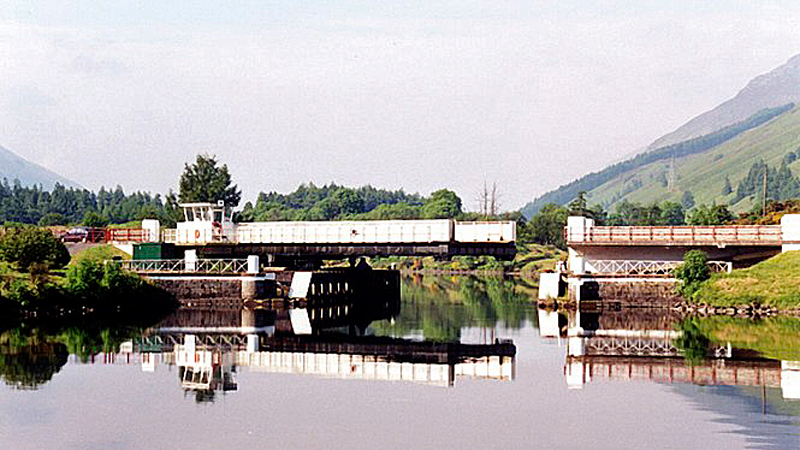
Swing bridge
Gairlochy, a tiny settlement with about 100 people, is surrounded by several other small crofting settlements, the largest of which is Achnacarry. Close by is Highbridge, the site of the first clash of the 1745 Jacobite uprising. Between 1803 and 1822, the Caledonian Canal was built, passing through the settlement and over the original site of the River Lochy. Two locks were built for access onto Loch Lochy, but only one, the Upper Lock, is still in use. At the lower lock, an end-pivoted swing bridge carries the road and Great Glen Way over the canal.
Banavie is a small town near Fort William and one of the nearest villages to Ben Nevis. Some suggest that Banavie is one of the possible birthplaces of Saint Patrick. Son of a Roman tax collector, the theory suggests he was born at Banavie around 389 AD after his family had come with the Romans, who had invaded the West Highlands and Islands. The place name Bannavem Taburniae is mentioned in one of only two known authenticated letters by the Saint. Ben Nevis dominates the skyline, with the scenery around Banavie being exceptional. The Caledonian Canal passes through Banavie, before ascending Neptune’s Staircase, the longest lock flight in Britain.
Corpach, Gaelic for “field of corpses”, is so named as it was a resting place when taking coffins of chieftains on the way to burial on Iona. It is a large village north of Fort William with a natural harbor. During the First World War, the United States Navy had a base there as part of the laying of the North Sea Mine Barrage. The United States shipped naval mines to Corpach and sent them to the Inverness base along the Caledonian Canal, where it joins Loch Linnhe at Corpach.
The earliest recorded settlement on the site at Fort William is a Cromwellian wooden fort built in 1654 as a base for English troops to “pacify” Clan Cameron after the Wars of the Three Kingdoms. The post-Glorious Revolution fort was named Fort William after William of Orange, who ordered it built to control the Highland clans.
In 1745, the final Jacobite rebellion began, led by Prince Charles Stuart (Bonnie Prince Charlie). Fort William was besieged for weeks by the Jacobites. Although the Jacobites had captured both of the other forts in the chain of three Great Glen fortifications (Fort Augustus and Fort George), they failed to take Fort William. The rebellion ended with the Government victory at the Battle of Culloden (1746).